
This is part of our special feature on Europe-China Relations.
Introduction
In January 2017 the first direct rail freight service linked China and the UK. Both sides celebrated the train arriving in London after a long journey via Kazakhstan, Russia, Belarus, Poland, Germany, Belgium, and France, as a modern version of the ancient silk road whose history dated back to 200 BC. This historical context is crucial, as it shapes the “One Belt, One Road” initiative launched by the Chinese government in 2013. Their reference to the historical silk road initiated a discussion within global historiography. As Folker Reichert has put in a nutshell: in sharp contrast to its contemporary political significance, the silk road did not and does not exist in the way that twenty-first century politics is quoting the past, namely as a coherent corridor connecting Asia and Europe.[1]
This paper critically discusses the implementation of the Chinese silk road initiative by putting it in a historical context, and it investigates the powerful and ambivalent use of the past in the twenty-first century. This contribution traces the way in which social sciences and humanities can contribute to analyzing a rationale which is, on the one hand, related to the history of Western imperialism, while distancing itself from an exclusively national expansion on the other.
The hypothesis presented in this article understands the new silk road project as an expression of change in the notion and practices of geopolitics. It contrasts national claims of power expressed by the silk road project with an analytical approach related to European Global Studies.[2] Within this rationale, a historically driven interdisciplinary approach is focusing on multilayered connections across borders and considers the multiplication of actors in international relations as a fundamental characteristic of the modern world. In doing so, this approach challenges a territory-based understanding of power. It recognizes connectivity as a source of power and considers the participation in transboundary networks, international organizations, and multilateral contexts as a historical alternative to national historiographies.
Building on this interpretation, this article aims to understand how the past is used in the twenty-first century. Furthermore, this contribution delivers insight to a global history that is able to contextualize the specific challenges today’s societies are exposed to. The following section analyzes the silk road as a historical metaphor, whose conceptualizing power developed an ambivalent historical rationale. Understanding it adequately requires an approach beyond methodological nationalism and national historiographies. A second part investigates the debates on how a “world connecting” translated into world views, and to what extent new forms of power detached from territorial property developed.
Dressing up global infrastructures – an imperial project
Chinese news is presenting the new silk road project with a strong reference to a deep historical past, imaging the silk road as a bustling trading route established centuries ago. The narrative usually does not mention the very fact that the concept of a silk road in the sense of a coherent trading route only surfaced as recently as 1877. Ferdinand von Richthofen (1833-1905), a Prussian geographer and explorer, coined the term “Seidenstrasse” by connecting the various existing trading routes into one concept, often used in the plural form as silk roads.[3] The term made a successful journey among Western explorers. As mentioned by David Graf, proving the existence of the silk roads turned into an ambition for adventurers who focused on the difficulties to cross the deserts of central Asia.[4] Imbued with Western imperialism and closely connected to academic adventurers such as Sven Hedin[5] with considerable talents in popularizing their findings, the metaphor is just one among many other projections designed to grasp the world as an entity.[6] However, allocating ex post a historical existence to the trading routes connecting Asia and Europe, introduces an interesting counter narrative that challenges the established presumption of global history.
With Emily Rosenberg as an example, state of the art global history explains the outcome of the late nineteenth century as a “world connecting”[7] based on modernization-driven investments in communication technologies. In this critical, but still modernization-driven approach, transcontinental railways and fast telegraph transmissions shrank distances under the lead of Western economic, colonial and imperial power. Using with the silk road an explicitly premodern space as a theme for twenty-first century investments, shifts the narrative from a Western, modernization-driven chronology to a different message in which newcomers in global markets act independently from Western paths by reconnecting to an imagined glorious past. Even more, by reversing the perspective from following Western colonial strategies to initiating networks based on the historicity of Chinese connections spreading from Asia to Europe, this conceptual reversal does not exclude an emulation of colonial practices, as explained below in the case of the railway-based networks. The Chinese silk road project combines different forms of connections, merging the railway-based with the shipping connections, but also including the often underestimated Arctic sea.
However, the silk road on rails is the historically most spectacular part, showing obvious tensions between its colonial past and the Chinese use of long-distance railways as a new alternative to less expensive but time-consuming shipping, and the faster but more expensive air transportation. The Chinese version of the silk road on rails is not limited to the already existing freight routes crossing the central Asian states. As presented by Banning and Mani, an additional rail system is planned to make use of the geopolitical advantage, which an Iranian five years “connectivity agenda” is expected to offer.[8] This part of the silk road project connects China and Central Asia with Western Asia, connecting Almaty to Teheran and opening up a fast link between the Iranian capital and Istanbul.
Compared to a project to which the Western press has attributed the incredible sum of 900 billion dollars , the nineteenth century forerunners preferred a multilateral concept of shared power. In contrast, the modern silk road project has a bilateral profile and is based on a variety of treaties between China and the states related to the economic corridors mentioned. However, for those having doubts about the feasibility of a railway route crossing the most contentious regions actually coming into existence, there is another lesson to be learned from the historical railway corridors: sometimes plans do not need to come into practice in order to unfold their political potential. Starting with the late nineteenth century, transcontinental railways found a strong narrative and supporter in Cecil Rhodes, who suggested to enhance British imperial power by building a railway and an uninterrupted telegraph line from Cape to Cairo. The initiative is a paradigmatic case for different reasons. As a never realized railway the concept raises our awareness of the challenging technical and economic difficulties connected to such projects. At the same time, Cape to Cairo transcended the limits of reality by remaining a politically powerful and mobilizing metaphor even without practical consequences. On the other hand, the Trans-Siberian railway became a crucial project for Russian access to Siberia and claims in Asia, while the Berlin-Baghdad network shows the long afterlife those plans had, even without the presence of the German state after 1918.
The lessons of the past differ substantially with regard to China, where since the late nineteenth century, railways have been both metaphors of multilayered and multilateral Western investment strategies, and a crucial tool in the limitation of Chinese sovereignty. Railway concessions resulted from complex bargaining strategies among Western powers including Japan. Railways covered extraterritorial spaces, promoting railway companies to state-like actors with their own rules, legislations and military forces.[9] It is not by coincidence that World War II in Asia started with the so-called Manchurian Incident in 1931, a terrorist attack which destroyed the South Manchurian Railway (SMR) owned railway tracks nearby Mukden. Under the pretext of reestablishing safety, the Japanese army invaded Manchuria and supported the establishment of Manchukuo, a Japanese puppet state that was not recognized by the League of Nations.[10]
Global world views beyond the national narrative
Although encompassing the globe, the Chinese silk road project is a national initiative which is based on a multitude of bilateral agreements. This section investigates this fact against the background of a global approach which focuses on processes of multilateral entanglements. Based on the idea that connectivities created coherent spaces that contributed to the development of world views beyond national politics, the question is therefore to what extend the perception of a coherent world view changed and whether such changing world views influenced the Western perception of Chinese actors. The sources used in this paragraph are first of all world maps outlining the way in which an accurate visual presentation from different historical periods handled the problem of depicting connectivities. While in the first section the Chinese concept of silk roads on rails was shown to merge a premodern past with long distance railway concepts in a way which allows the sidelining of a Western-dominated modernization discourse, this section uses ships as a main indicator of presenting the changing world views for two reasons: Firstly, the Chinese silk road project has an explicitly mentioned maritime counterpart, the maritime silk road, and secondly, a maritime map, the Mercator map, has shaped the access to the globe for more than 400 years.
With regard to the maritime silk road, the project includes different “blue economic passages.”[11] One connects the Chinese ports in the South Chinese Sea with ports in the Indian Ocean, while posts at the African coast lead via the Suez Canal to the Mediterranean Sea. A second blue corridor links the South Chinese Sea to the Pacific Ocean, and the third and less elaborated plan is supposed to access Europe via the Arctic sea.
This considerable increase in shipping as part of the silk road metaphor presents Chinese activities in a field which has been crucial for Western-coined world views since the sixteenth century, coincidentally the beginning of a period when Chinese ships had disappeared from the seven seas. Since the late sixteenth century, the Mercator-based world map has shaped the common understanding of the world, although introducing an insolvable cartographic problem: By using a conformal approach, the Mercator map was useful for long distance nautical navigation. However, the impossibility to adequately display the three-dimensional globe on a two-dimensional map resulted in geographical distortions which increased the apparent size of the countries close to the poles and diminished the appearance of those located around the equator. The orientation of the map along the prime meridian enhanced the Western-focused understanding of the world, where Africa and Asia are bigger than they appear and Asia is relegated to the fringe.
Debates about how to display a “world connecting” beyond Eurocentrism have increased recently as part of a postcolonial discourse.[12] However, the problem is as old as the maps are, and a discussion about monopolies of interpretation seems unhelpful if it remains limited to the uncontested fact that the Mercator-related maps privilege the Western naval powers. However, there are some good reasons for asking to what extent these maps enable mirroring the bargaining processes that have shaped global connectivities. After all, ships and the sea have had a long-lasting tradition as hinges connecting territory-based legal frameworks with international law. Maritime law, the agreements on time zones, the legal framework in port cities and the invention of tax-exempt off-shore centers are all necessarily based on multilateral agreements which have developed from the nineteenth century onwards. Are there any consequences for latecomers in the fields of multilateral agreements? In contrast to the early presence of Japanese representatives in such multilateral deliberations,[13] until 1949 the Chinese state used to be the object of international deliberations rather than a participating power in multilateral gatherings. The modern version of the blue economic passage or maritime silk road is neither a contribution to an international organization nor a multilateral approach but is based – again – on bilateral treaties with port-owning states.
As has been discussed for a while in histories of global governance and international relations, weak states or states with contested sovereignty have usually a successful history of global networking by using international organizations of all kinds as a backdoor to power.[14] The description of China as a marginalized latecomer is therefore problematic, while emphasizing Chinese exceptionalism as a strong undercurrent remains more reliable. To take the example of cartography, although Western influence on cartography in China seems to be developing in parallel to the spread of the Mercator map, scholars are rather reluctant to confirm an adoption of Western cartography in China. Yee pointed at only “few traces of European influence” from the late sixteenth to the beginning of the twentieth centuries and unravels a presumed westernization of Chinese cartographic works as a myth.[15] While the adaptation of world views in cartographic works presents just one example of asymmetrical perception, the changing representation of connectivities in the world maps published in the 1930s documents the increasing impact of globality on local grounds. In a world map published in the Japanese journal Hinode in 1932, the illustrator Shishido Sako grasped a world with porous borders, crossed and connected by radio and airplanes, the seven seas densely populated with submarines, ships and divers, a heavily armed world involved in conflicts with fighting Chinese warlords at its center.[16] Indeed, the global mapping changed substantially in the 1930s, since airplanes connected places even if the territories were far distant from each other. It is interesting to mention that the debates now revolve around the Arctic, which is the third center piece in today’s silk road concept. A closer look at the Arctic in the history of a “world connecting” reveals a highly contested space even before global warming increased its accessibility by ship and before states claimed the rich resources hidden under the grounds of the frozen sea.
In his comments about airships crossing the Arctic, the Canadian Polar researcher Vilhjalmur Stefansson declared the beginning of a new Air age – with crucial consequences, since Asia was now reachable from the East, the West, and the North. This often-quoted explanation[17] was in accordance with the world maps newly created during World War II. Although still based on the Mercator projections, the now used azimuthal projection moved the Arctic to the center of the world map. This imagination of a connected world addressed the allied forces by pointing at “One World, One War,”[18] explaining to US soldiers why a distant battlefield was nevertheless close, since on this type of world map the continents face each other around the Arctic ocean.[19] The imagination of a world connected through the Arctic has remained a powerful narrative which was not limited to wartime legitimacy but provided also the new emblem of the United Nations.
Conclusions
Although the conceptual planning of the territory-based silk road and maritime economic channels have already been realized at least in some crucial parts, it is the transpolar sea route which, though still vague, particularly helps to specify the structural sea change introduced by the Chinese silk road project. The silk road on rails is based on bilateral agreements with a big number of states and avoids the global entanglements of foreign investments and legal claims which the historical transcontinental railway line was built on. The same is true for the blue economic channel, again based on bilateral treaties with certain port-owning states, and again avoiding to address the naval-based development of connectivities along the specific extraterritorial rules that had emerged from a world connected by naval powers. In the case of the Arctic, this highly relevant metaphor of global governance is a focal point of international law making and regulations, with the United Nations Convention on the Law of the Sea (UNCLOS) balancing the different claims and responsibilities of a variety of states. Experts agree that the planned transpolar sea route lies outside the dense international regulations controlled by UNCLOS.[20] Despite the official presentation of the silk road and belt project as an endeavor in close international cooperation, the international activities are based on bilateral agreements with a strong emphasis on geopolitical considerations. One could go so far as to say that the silk road project rather avoids multilateral settings and (re)introduces asymmetrical power relations. The world map of the twenty-first century is based on a network of bilateral treaties with actors that were not known before in this international setting: By strengthening Eurasian countries and Iran as transit countries, African ports as access to the Mediterranean Sea and Iceland as destination for the Chinese icebreakers crossing the Arctic, the silk road related world map marginalizes first of all the European capacity in organizing connectivities on a multilateral level.
Madeleine Herren is professor for Modern History and Director of the Institute for European Global Studies at the University of Basel, Switzerland. Her academic background is in European historiography and she specializes in the history of international organizations and transnational movements.
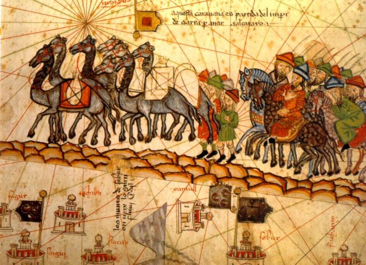
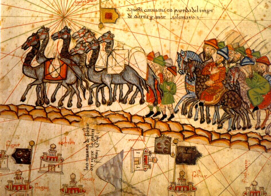
Photo: An 1830 image depicting a caravan on the Silk Road. Source: Wikimedia Commons.
[1] Folker Reichert, Asien und Europa im Mittelalter, Göttingen 2014; Hansen, Valeria: The Silk Road. A New History, London 2012; Mair, Vincent H./ Hickman, Jane: Reconfiguring the Silk Road. New Research on East-West Exchange in Antiquity, Philadelphia 2014.
[2] Madeleine Herren, European Global Studies: The Historicity of Europe’s Global Entanglements with a Focus on Interdisciplinary Research, in : Potentials and Challenges of Global Studies for the 21st Century, Global Europe – Basel Papers on Europe in a Global Perspective No. 105 (2014), p. 6-16.
[3] Richthofen, Ferdinand von: China: Ergebnisse eigener Reisen und darauf gegründeter
Studien Vol. 1, Berlin 1877; Richthofen, Ferdinand von: Über die centralasiatischen Seidenstrassen bis zum 2. Jahrhundert n. Chr., in: Verhandlungen der Gesellschaft für Erdkunde zu Berlin (Jan- Dec. 1877), pp. 96 – 122. For the development of the idea, see.: Chin, Tamara: The Invention of the Silk Road, 1877, in: Critical Inquiry 40 (2013), pp. 194.
[4] Graf, David F.: The Silk Road between Syria and China, in: Bowman, Allan (ed.): Trade, Commerce, and the State in the Roman World, Oxford 2017, p. 447.
[5] Hedin, Sven: The Silk Road, London 1938.
[6] Following this perspective, the discovery of the silk road is mirrored in similar endeavors to discover the well of the Nile, the Northwest passage or access to Tibet.
[7] Rosenberg, Emily (ed.): A World Connecting. 1870 – 1945 (A History of the World), Harvard 2012; Wenzlhuemer, Roland: Connecting the Nineteenth Century World. The Telegraph and Globalization, Cambridge 22014; Conrad, Sebastian: What is Global History?, Princeton / Oxford 2016; Osterhammel, Jürgen: The Transformation of the World. A Global History of the Nineteenth Century, Princeton 2014.
[8] Banning, Tim / Mani, Lukas: Iran-Europe Transport Corridors, in: ETR International Edition 1 (2018), pp. 25 – 30.
[9] Bickers, Robert: Out of China. How the Chinese ended the Era of Western Domination, London 2017; Elleman, Bruce A. / Kotkin, Stephen: Manchurian Railways and the Opening of China: An International History, Armonk and London 2010; Davis, Clarence Baldwin: Railway Imperialism in China, 1895-1939, in: Baldwin, Clarence / Wilburn, Kenneth E. (eds.) Railway Imperialism, New York / Westport, Conn./ London 1991, pp. 155-173; Huenemann, Ralph William: The Dragon and the Iron Horse. The Economics of Railroads in China 1876-1937, Cambridge, Mass./ London 1984.
[10] Mitter, Rana: China’s War with Japan, 1937 – 1945. The Struggle for Survival, London 2013; Duara, Prasenjit: Sovereignty and Authenticity. Manchukuo and the East Asian Modern (State and Society in East Asia Series), Oxford 2003.
[11] China proposes ‘blue economic passages’ for maritime, in: China Daily online, http://www.chinadaily.com.cn/business/2017-06/21/content_29825517.htm (14.05.2018).
[12] Five maps that will change how you see the world, in: The Conversation, http://theconversation.com/five-maps-that-will-change-how-you-see-the-world-74967 [14.05.2018].
[13] See the online database ‘League of Nations Search Engine’, www.lonsea.de. As an additional example see the list of participants of the prime meridian Conference in 1884 in Washington, https://www.staff.science.uu.nl/~gent0113/idl/images/imc_1884.jpg.
[14] Herren, Madeleine, Internationale Organisationen seit 1865. Eine Globalgeschichte der internationalen Ordnung, Darmstadt 2009; Herren, Madeleine, Hintertüren zur Macht. Internationalismus und modernisierungsorientierte Außenpolitik in Belgien, der Schweiz und den USA (Studien zur Internationalen Geschichte 9), München 2000.
[15] Yee, Cordell D. K.: Traditional Chinese Cartography and the Myth of Westernization, in: Harley, J.B. and Woodward, David (eds.): Cartography in the Traditional East and Southeast Asian Societies (The History of Cartography Series II, 3), Chicago/London 1994.
[16] Hitome de wakaru manga sekai manga genjō chizu, Tokyo, Shinchōsha, Shōwa 7 [1932]. 76x104cm, online: The National Library of Australia, http://nla.gov.au/nla.obj-359516141/view [14.05.2018].
[17] Air Mail to China. Explorer’s Plan for Service via Behring Strait, in: The Singapore Free Press and Mercantile Advertiser, 10.09.1928, 3; Renner, G. T.: Human Geography in the Air Age (A Text for High School Students), New York 1942.
[18] Harrison, Richard Edes: One World, One War, New York 1944, 36x29cm, online: David Rumsey Map Collection, https://www.davidrumsey.com/luna/servlet/detail/RUMSEY~8~1~266317~5504873:One-World,-One-War.
[19] Ibid.
[20] Humpert, Malte; Raspotnik, Andreas: The Future of Arctic Shipping along the Transpolar Sea Route, in: The Arctic Yearbook 2012, pp. 281 – 307, p. 288, online: https://arcticyearbook.com/images/Articles_2012/Humpert_and_Raspotnik.pdf.
Published on June 5, 2018.